scienceMar 14, 202524:34pending
Tornado Outbreak: Rare Level 5 “High Risk” for Severe Weather
About this episode
Timeline of Main Events (March 14-16, 2025)
Friday, March 14, 2025:
- Evening/Overnight:Severe Thunderstorm Watches are in effect from Iowa and Nebraska southward to Kansas and Missouri.
- Tornado Watches are in effect for a large part of Missouri, Illinois, and Arkansas, extending to the Gulf Coast.
- Parts of north and west Alabama are under a Level 3 out of 5 risk for severe weather starting late tonight (around 11 PM or later), with a "conditional" threat of intense storms if a "cap" of warmer air doesn't hold.
- Areas west of this zone in Alabama, including Huntsville and Birmingham, are under a Level 2 risk, and areas further south are under a Level 1 risk. Southeast Alabama is not expected to see severe weather tonight.
- Storms in west Alabama are expected to develop around 11 PM and move eastward through the overnight hours.
- The Tallahassee area in Florida could see storms arriving as early as midnight or 1 AM Sunday, with the more likely window from 4 AM to 10 AM.
Saturday, March 15, 2025:
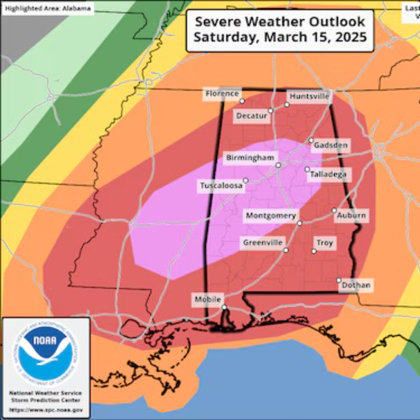
- All Day: A widespread and dangerous severe weather outbreak is expected across the central Gulf Coast states and Deep South into the Tennessee Valley.
- Morning: Confidence increases about the probability of widespread severe storms in Alabama, particularly from Saturday afternoon until early Sunday morning.
- Daytime/Afternoon:A tornado outbreak is possible across the central Gulf Coast states and Deep South into the Tennessee Valley.
- Multiple intense, long-tracked tornadoes (EF-3 or higher) are possible on Saturday.
- The storms will develop along the Mississippi River and quickly move east from midday to the afternoon.
- A line of supercells is expected to swing through central and southern Mississippi into northern Alabama, central and east Tennessee, and north Georgia.
- Cities such as New Orleans, Louisiana, and Birmingham, Alabama, are under a Level 4 out of 5 risk.
- In Alabama, there could be supercells or individual severe storms producing tornadoes, followed by a squall line moving west to east across the state.
- Storms could begin to affect Alabama around noon and last into early Sunday morning.
- The Storm Prediction Center's highest risk level (Level 5 out of 5) impacts 2.7 million people in major cities like Birmingham, Jackson, Tuscaloosa, Hoover, and Hattiesburg.
- Night: The severe weather threat in Alabama is expected to continue through early Sunday morning.
Sunday, March 16, 2025:
- Early Morning: Storms will be tracking eastward and out of Alabama.
- Daytime: The storm system will have traversed the entire U.S., with its focus on the East Coast, including the Interstate 95 corridor.
- Threats on the East Coast: The threat of tornadoes will be confined to the Virginia coast and south into the Carolinas. Damaging wind gusts and large hail will be the main threats from Florida to the Northeast.
- Morning (Tallahassee): The severe weather threat could continue even after an initial round of storms moves through the Tallahassee area. Much of the eastern Big Bend is under a slight risk of severe storms for after 8 AM Sunday.
Get every episode summarized
Each time Meteorology Matters publishes, we email you a written briefing from the transcript — the topics, who appeared, and any specific claims, with the ad reads skipped.
Email me new episodesFree for 3 shows. No card needed.
No transcript yet
This episode has not been transcribed. Request it and it moves to the front of the queue.
More episodes
More from Meteorology Matters

“Will Hurricane Forecasts Get Worse? Inside the NOAA Budget Cuts
Meteorology Matters
Apr 13, 202632:47failed

Fired, Sued, and Still Forecasting: The Matt Devitt vs WINK News Battle
Meteorology Matters
Apr 4, 202637:38failed

“It Only Takes One”: Why 2026’s Hurricane Season Could Be Worse Than It Looks
Meteorology Matters
Mar 28, 202640:42failed

This Should NOT Be Happening in March… 112° Heat + Hawaii Flood Disaster
Meteorology Matters
Mar 21, 202638:28failed